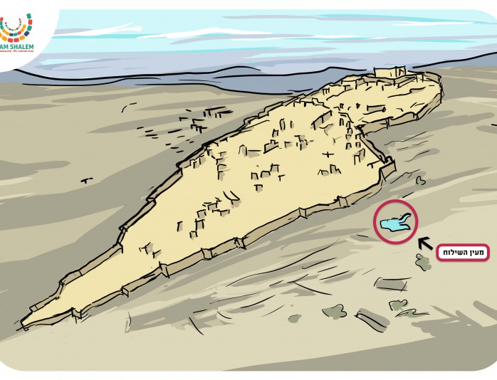
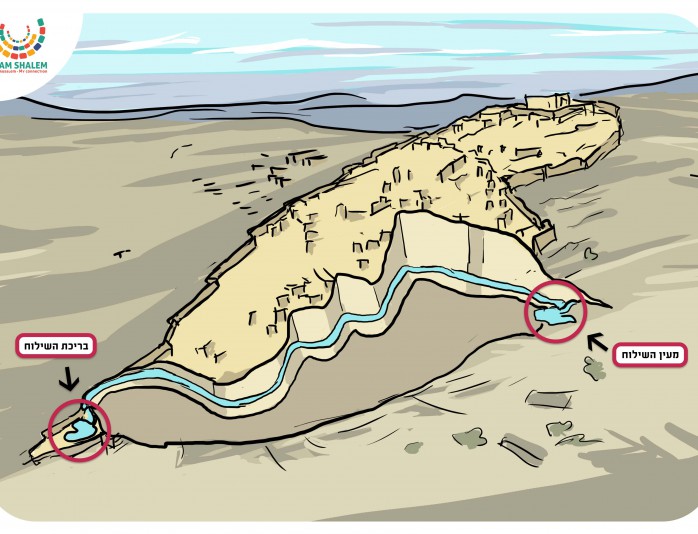
Each group will receive two topographic maps of Jerusalem; ancient Jerusalem and Jerusalem with a perspective of the whole country.
Afterwards, you will tell a story that describes the Jewish settlement in Jerusalem in the days of King David and its importance for the Jewish people. The topographic descriptions of the story can be illustrated using the map showing ancient Jerusalem.
The story:
3000 years ago, King David arrived in Jerusalem. In those days, it was not called Jerusalem, but Yevus.
The Yevusi people lived there and David conquered the city from them, built his palace and the capital city of Jerusalem. Jerusalem was built on a mountain slope and a wall was built around the city.
Why did David build Jerusalem there? On the mountain slope? Why not build it on flat land? By the sea?
According to what is written in the Tanach, the Temple was to be built on the top of a mountain, with Jerusalem built at the foot of that same mountain. The mountain is called Mount Moriah, Har HaMoriah.
Let’s think together what a place needs to have in order for it to be inhabitable?
Answers: water, food, protection, economic development (crops, trade) etc. Water is the basic
need- in order for there to be life, there must be water.
But where is the water situated in Jerusalem?
Answer: as can be seen on the second map, the water is concentrated in springs situated around Jerusalem, such as the Gihon and Lifta.
At the foot of the mountain – the rainwater that seeps into the ground is called groundwater and it accumulates in an impenetrable layer.
These two answers are the beginning of the survival challenge of the residents of Jerusalem.
